Directional Drilling in Baton Rouge
The first high ground on the river — a capital on the bluff, a chemical corridor on the levee front below it, and a flood-famous basin at its back door. Capital Region HDD is two-ground drilling in plant country — and it's ours.
HDD is the whole job here
Baton Rouge exists because of a change in elevation you can walk in a minute: the bluff, where the Pleistocene terraces — older, firmer, genuinely load-bearing ground — meet the Mississippi's young alluvial plain. That seam is the region's drilling map. On the terrace side (the capital, most of East Baton Rouge, Livingston, the Felicianas), bores run in stiff silts and clays with real standing strength — cooperative ground that behaves. Down on the alluvial side (the levee front, West Baton Rouge, Iberville, Pointe Coupee's bottoms), the river's soft young sediments take over, wet and buoyant, with the full delta program of engineered pits and ballasted pulls. Terrace-or-bottoms is the first question every Capital Region quote answers, and pricing one like the other is how schedules die here.
The river's edge is the region's economic engine and its most demanding workplace: the petrochemical corridor — the miles of refineries, chemical plants, and terminals lining both banks from the capital downriver through Ascension and Iberville. Utility work in plant country is industrial-grade by definition: facility safety cultures that govern every hour on site, pipeline neighbors in densities that rival any metro anywhere, rail serve threading the batture, and the mainline levees fronting it all — with the levee districts' engineering review and the federal flood-control interest behind them. Corridor fluency is the local trade skill, and it's built into our scoping.
East of the capital runs the region's other water story: the Amite basin, whose 2016 flood rewrote how Livingston and East Baton Rouge think about drainage — and whose ongoing flood-control program keeps crossing work and coordination requirements current across the eastern parishes. Behind the whole operation sits the network desk — 50,000+ boring calls answered, ~10,000 crossings quoted, 2,000+ drilled — pricing Capital Region scope with the bluff line already in the math.
Fiber-Optic Boring
Plant-corridor duct, campus fiber, and FTTH across the growth parishes.
Electrical Duct Boring
Plant feeders, hardening conversions, and growth-parish circuits.
Water & Force-Main Boring
Pressure pipe for parish systems racing growth on both sides of the bluff.
River Levee & Industrial-Corridor Crossings
The signature Capital Region bore: the levee front, the batture, and the basin.
Road & Highway Crossings
Parish, municipal, and DOTD crossings — with the bluff line in the price.
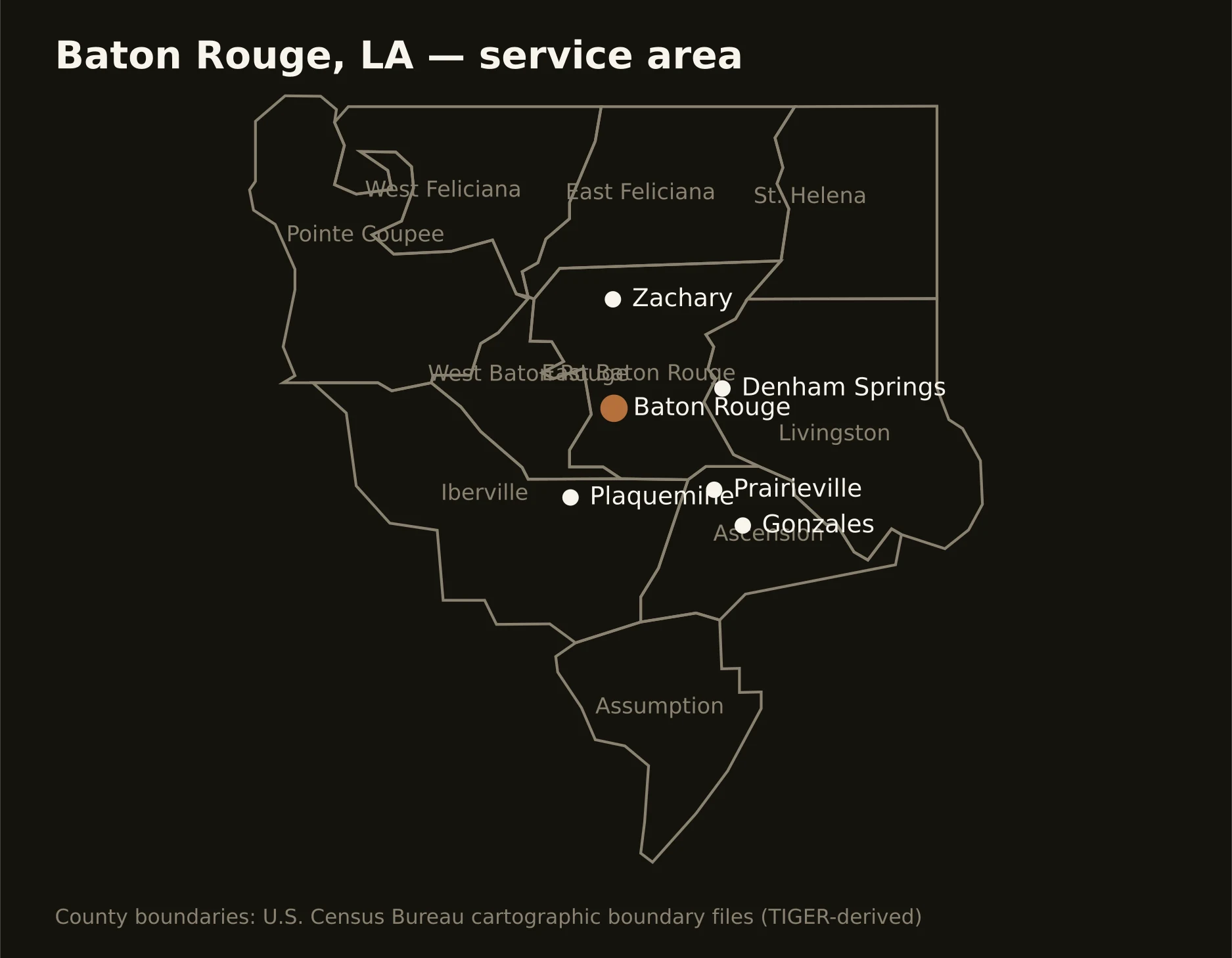
Ten parishes around the bluff — East Baton Rouge's capital core, Ascension's boom running down the chemical corridor, Livingston's flood-tested growth east, the river bottoms west across the bridge, and the Feliciana hills standing above it all. Full county list on the service-area page.